The West Coast: Bohuslän
The coast of Bohuslän (Bohuslän) north of Gothenburg is Sweden's most Atlantic-facing shore — a landscape of bare, smoothly rounded granite islands and skerries scoured by wind and waves. The rock here, predominantly Precambrian granite, has been polished by thousands of years of marine erosion into the distinctive pink-grey surfaces that define the region's identity.
The Bohuslän archipelago is more exposed and open than its east coast equivalents — fewer trees, more wind, and a culture oriented toward the sea. Fishing villages like Smögen, Fjällbacka, and Marstrand cling to the granite. The Bronze Age rock carvings at Tanum, depicting ships, warriors, and rituals, testify to a maritime culture stretching back over 3,000 years.
The High Coast (Höga Kusten (High Coast))
The High Coast in Ångermanland, roughly halfway up Sweden's Bothnian coast, is a UNESCO World Heritage Site — and the world's foremost example of post-glacial land uplift. Since the ice sheet retreated roughly 10,000 years ago, this section of coast has risen nearly 300 metres — the highest documented isostatic rebound anywhere on Earth.
The result is a dramatic, mountainous coastline that looks out of place on a relatively flat sea. Cliffs rise steeply from the water, and features that were once on the seafloor — wave-washed caves, beach terraces, smooth-polished rock — are now found hundreds of metres above the current waterline. The Skuleskogens nationalpark (Skuleskogen National Park) protects a section of this landscape, offering trails that pass through ancient coastal caves now deep in the forest.
The land continues to rise here at roughly 8 millimetres per year. Islands are slowly growing, bays are becoming lakes, and the coastline is measurably different from one generation to the next.
The Stockholm Archipelago (Stockholms skärgård (Stockholm Archipelago))
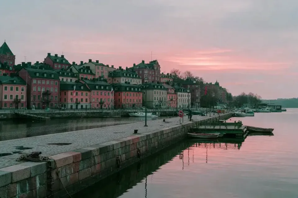
The Stockholm archipelago is one of Europe's largest, a vast maze of islands ranging from sizeable, forested, and inhabited inner islands to bare, rocky outer skerries where only seabirds and seals reside. The archipelago sits on Precambrian granite and gneiss, sculpted by glacial erosion into the elongated, northeast–southwest-trending forms visible on any map.
For Stockholmers, the archipelago is an extension of the city — a summer landscape of red-painted cottages, sailboats, bathing rocks, and herring. For geologists, it is a textbook example of glacially shaped coastal topography. The transition from inner to outer archipelago is a gradient from sheltered, soil-covered islands to exposed, wave-washed rock — a microcosm of the forces that have shaped Sweden's entire coastline.
The Bothnian Coast
Sweden's east coast north of Stockholm — facing the Gulf of Bothnia — is shaped by the ongoing process of land uplift. This is the coast that is most actively changing, with new skerries emerging, bays becoming isolated lakes, and harbours gradually shallowing.
The Kvarken (Kvarken Strait) — the narrowest point of the Gulf of Bothnia between Sweden and Finland — is a particularly striking example. The Finnish side (the Kvarken Archipelago) is a UNESCO World Heritage Site alongside the High Coast for the uplift process they share. On the Swedish side, the coast around Umeå and Skellefteå shows similar dynamics: a flat, low-lying shore of moraine deposits and young, still-rising islands.
Further north, the Bothnian Bay coast becomes increasingly flat and marshy, with extensive strandängar (coastal meadows) that provide crucial habitats for migratory birds.
Gotland and the Limestone Coast
Gotland (Gotland), Sweden's largest island (3,140 km²), has a coastline fundamentally different from the mainland. Built of Silurian limestone roughly 420 million years old, Gotland's shores feature:
- Raukar (Sea stacks) — Tall, sculpted limestone pillars standing along the coast, created by differential erosion of hard and soft rock. The most famous formations are at Fårö (the island's northern tip, beloved by filmmaker Ingmar Bergman) and Gotland's east coast
- Fossil-rich cliffs — The limestone contains abundant fossils of corals, crinoids, and trilobites from when Gotland lay beneath a tropical sea
- Sandy beaches — Some of Sweden's finest, particularly at Tofta and on the island of Fårö
Gotland's smaller neighbour, Öland (Öland), also has a limestone coast, with the distinctive flat Stora Alvaret (Great Alvar) reaching down to the sea on its western side.
The Southern Coast: Skåne
Sweden's southernmost coastline shifts character again. In Skåne, the bedrock changes from crystalline shield to sedimentary rock, producing:
- Sandy beaches — The entire south coast from Ystad to Trelleborg, plus the northern Öresund shore, features wide sand beaches — unusual by Swedish standards
- Chalk cliffs — At Simrishamn and along the southeast coast, Cretaceous chalk cliffs evoke the English Channel coast
- Öresund — The narrow strait separating Sweden from Denmark, crossed since 2000 by the Öresund Bridge linking Malmö to Copenhagen
The south coast has a more continental European feel — warmer waters, sandy shores, and a flatter profile — quite different from the granite and archipelago landscape further north.
Coastal Ecology and Conservation
Sweden's coastline supports rich and varied ecosystems:
- Seabird colonies — Outer skerries host breeding colonies of eider, guillemot, razorbill, and terns
- Seal populations — Grey seals and harbour seals haul out on rocks along both coasts
- Baltic Sea ecology — The brackish Baltic supports a unique mix of freshwater and marine species, though eutrophication and warming pose serious threats
- Coastal wetlands — Strandängar (coastal meadows) along the Bothnian and southern coasts are vital stopover sites for migratory birds
Sweden has expanded its marine protected areas significantly in recent decades. Kosterhavet National Park (2009), off the west coast, was the country's first marine national park, protecting the most species-rich marine environment in Swedish waters.
Gothenburg city guide — Explore the archipelago from Sweden's west coast capital
The Viking Age — How Sweden's coastline shaped its seafaring history
Summer coast itinerary — Island-hopping along Sweden's most beautiful shores